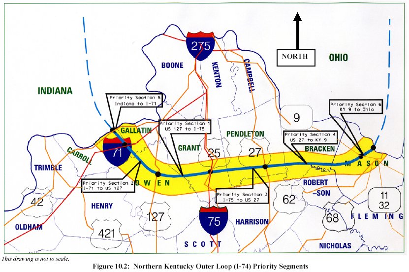
[<<< Previous Image] [KentuckyRoads.com - Maps] [Next Image >>>] This map is an extract from the final report on I-74 . See also Interstate 74. Gallery: KentuckyRoads.com - Maps [<<< Previous Image] [KentuckyRoads.com - Maps] [Next Image >>>] Updated: 27-Jul-2003 1:26AM CDT