
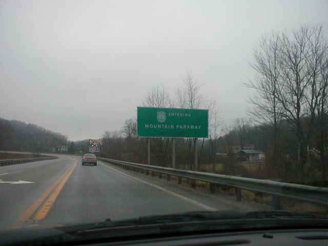
"Entering Mountain Parkway" [details]
The Mountain Parkway, known as the Eastern Kentucky Turnpike during planning, opened as a toll road in 1963 and was widely heralded as opening up eastern Kentucky to the rest of the state. In 1976, the road was renamed the Bert T. Combs Mountain Parkway in honor of the former governor who is widely credited with getting the road built. Tolls were lifted west of Campton in 1985 and to the east the following year.
The Mountain Parkway was the first parkway to be constructed and the first parkway to have its tolls removed; however, it was the second toll road in state: it was proceeded in construction and lifting of tolls by the Kentucky Turnpike.
The road is four lanes west of Campton and two lanes to the east. The entire length of parkway is full-controlled access. The two lane portion is a super-two ![]() . For added safety, the two lane portion has a rumble strip down the centerline of the highway. This serves to alert drivers who may be drifting into the oncoming lane. The two lane portion of the parkway is designated in route logs as the Mountain Parkway Extension.
. For added safety, the two lane portion has a rumble strip down the centerline of the highway. This serves to alert drivers who may be drifting into the oncoming lane. The two lane portion of the parkway is designated in route logs as the Mountain Parkway Extension.
In April of 1985, the road was designated was KY 114 in official route logs. In August of that year, it was redesignated KY 402. Finally, in February of 1990 the parkway was given its original route log designation: KY 9000 for the four lane portion and KY 9009 for the two lane portion. I do not know if the parkway was ever signed as KY 114 or KY 402. The parkway is currently only signed as the Bert T. Combs Mountain Parkway; however, some maps still show the parkway as KY 402. (The KY 402 route number is now used to designated an old section of KY 80 in western Kentucky.)
Present day KY 114 between Saylersville and Prestonsburg appears to be considered by some residents to be part of the Mountain Parkway extension; however, it is designated the Saylersville-Prestonsburg Road in official route logs.
- The parkway is 75.627 miles long. The four lane portion is 43.104 miles long; the two-lane portion (known as the Mountain Parkway Extension) is 32.523 miles long.
- The four lane portion is designated as state route KY 9000 in official route logs, and the two lane portion is designated as KY 9009 in official route logs.
- H.B. Elkins: Mountain Parkway
![[Outside Link]](../images/kentuckyroads/outside-link2.gif) - A detailed guide to the Mountain Parkway's exits.
- A detailed guide to the Mountain Parkway's exits. - Kentucky Post: The quiet man; New YMCA honors philanthropist's contributions (July 29, 2003) - Article about a R.C. Dunn, the owner of the contracting firm that was awarded the contract to build the parkway in 1961.
- KentuckyRoads.com: Mountain Parkway Exit 72 - A photograph of a typical section of the two-lane portion of the Mountain Parkway at Exit 72.
- Ohio Valley Transit: Bert T. Combs Mountain Parkway - Information about the highway.
Mountain Parkway News Items
![[Bert T. Combs Mountain Parkway]](../images/shields/newmtnpkwysign_small.jpg)
Mountain Parkway Expansion News - Weeks of August 11 and 24
The Kentucky Transportation Cabinet has posted a status report for the Mountain Parkway Expansion project ![]() . This week's report covers work in and around Saylersville.
. This week's report covers work in and around Saylersville.
The August 11 report ![]() from the Transportation Cabinet discusses the selected alternative for the widening of the Mountain Parkway in Wolfe County.
from the Transportation Cabinet discusses the selected alternative for the widening of the Mountain Parkway in Wolfe County.
Month-long bridge repair project on Mountain Parkway begins Monday, Sept. 10
From Kentucky Transportation Cabinet Department of Highways District 10 (Sept. 5, 2012):
Month-long bridge repair project on Mountain Parkway begins Monday, Sept. 10
Traffic to be reduced to one lane and controlled by temporary signals at Morgan-Magoffin county line
JACKSON, KY – A bridge repair project scheduled to begin Monday, Sept. 10 on the Bert T. Combs Mountain Parkway in Wolfe County will result in one-lane traffic and delays for motorists using this main eastern Kentucky highway artery.
Temporary signals will control traffic at the Mountain Parkway’s span at the Morgan-Magoffin county line near mile marker 63. These temporary signals will be in place for approximately four weeks as work on a bridge deck overlay project proceeds.
Public Meeting Held to Discuss Proposed Improvements to Mountain Parkway in Powell County
From KYTC Department of Highways District 10 on Sept. 16, 2009:
Transportation Cabinet conducts public meeting on proposed improvements to Mountain Parkway Exit 18 in Clay City
JACKSON, KY – On Tuesday, Sept. 15, personnel from the Kentucky Transportation Cabinet Department of Highways District 10 office conducted a public hearing on the proposed improvements to Exit 18 of the Bert T. Combs Mountain Parkway in Powell County.
Transportation Cabinet schedules Aug. 27 public hearing to discuss Mountain Parkway widening project
From the Kentucky Transportation Cabinet Department of Highways District 10 on August 14, 2009:
Transportation Cabinet schedules Aug. 27 public hearing to discuss Mountain Parkway widening project
JACKSON, KY – Residents of Magoffin, Morgan and Wolfe counties are invited to attend a public hearing to discuss a project to widen the Bert T. Combs Mountain Parkway to four lanes between Exit 57 at Helechawa in Wolfe County and Exit 75 near Salyersville in Magoffin County.
The hearing will be held Thursday, Aug. 27 from 5 to 7 p.m. at Lakefront Church of God on KY 134 in Magoffin County. The site is accessible from the Mountain Parkway via its intersection with KY 134 between mile markers 67 and 68.
Road and Ramp Closures Due to Mountain Parkway Widening Near Campton
The Mountain Parkway is currently being widened between exits 43 and 46 near Campton. Several bridges and ramps will be replaced as part of this widening project.
“Hoax” Claims Mountain Parkway Rest Area to be Closed
In late July, someone posted signs at the Slade rest area claiming that the Mountain Parkway’s only rest area would be closed. The signs suggested that motorists call Frankfort to stop the closing; however, the state has no plans to close the rest area. Though, the state is looking for someone else to take on the financial responsibility of running the facility: Lexington Herald-Leader: Mountain Parkway rest area to stay open (July 29, 2004) ![]() , Lexington Herald-Leader: Try this slogan: Don't mess with our rest area (July 30, 2004)
, Lexington Herald-Leader: Try this slogan: Don't mess with our rest area (July 30, 2004) ![]()
Over Two-hundred Photographs Added
Two-hundred-and-sixty-two photographs of Kentucky's roads have been added to this website. The new photo galleries include:
- Bridges of the Ohio River - Several of Kentucky's 40 bridges across the Ohio River.
- William H. Harsha Bridge Photographs - Photographs of Kentucky's first cable stayed bridge: the William H. Harsha bridge near Maysville.
- I-64 - Sherman Minton Bridge - The I-64 and US 150 bridge over the Ohio River in Louisville.
- Shortway Bridge - The Old KY 1120 bridge over the Licking River between Kenton and Campbell Counties.
- I-65 - John F. Kennedy Bridge - The I-65 bridge over the Ohio River at Louisville.
- US 31 - George Rogers Clark Memorial Bridge (Second Street Bridge) - The US 31 bridge over the Ohio River at Louisville.
- I-65 - Miscellaneous Images
- KY 30 - Miscellaneous Images - Photographs of the new section of KY 30 under construction in Laurel County.
- I-65 Warren County Construction - June 29, 2001
- I-65 Warren County Construction - May 22, 2002
- I-65 Warren County Construction - August 15, 2002
- I-65 Warren County Construction - July 5, 2003
- I-75 - Miscellaneous Images - Includes photographs of I-75 widening projects south of Lexington.
- William H. Natcher Bridge - October 26, 2002
- William H. Natcher Bridge - February 8, 2003
- Louisville - Miscellaneous Images
- KY 3 and KY 645 - Inez - January 3, 2003
- AA Highway - Miscellaneous Images
- KY 67 - Miscellaneous Images
- KY 80 - Miscellaneous Images - Along KY 80 in Pulaski and Laurel Counties.
- KY 101 and KY 259 - Edmonson County - November 18, 2001 - A new section of KY 259 and KY 101 under construction in Edmonson County.
- US 23 - Miscellaneous Images
- US 60 - Miscellaneous Images - Photographs of the Cumberland and Tennessee River bridges.
A few new images have been added to the KentuckyRoads.com - Miscellaneous Signs and KentuckyRoads.com - General Images galleries as well.
Recent Professional Services Procurement Bulletins
Recent Professional Services Procurement Bulletins ![]() include a study on rebuilding the interchanges on I-65
include a study on rebuilding the interchanges on I-65 ![]() near the University of Louisville, a study on rebuilding KY 9 in urban Campbell County
near the University of Louisville, a study on rebuilding KY 9 in urban Campbell County ![]() , and studies about constructing two new interchanges on the Mountain Parkway
, and studies about constructing two new interchanges on the Mountain Parkway ![]() .
.
Parkways System and Cumberland Gap Tunnel Named Kentucky's Top Road Projects
The American Road and Transportation Builders Association (ARTBA) has named Kentucky's parkway system and the Cumberland Gap Tunnel as Kentucky's top road project. They also recognized Wendell Ford and Calvin Grayson as the state's top transportation officials.
More information: KYTC Press Release ![]()
KYTC Closes Some Rest Areas; Opens Others
The Kentucky Transportation Cabinet will be closing several rest areas and opening a few new ones over the next few years. Two rest areas on I-64 in Shelby County, three rest areas on I-65 in Warren County and Hart County, and two rest areas on I-75 in Madison County will soon be or have already been closed; however, Kentucky is planning to build two new rest areas on I-65 in Hart County, and a one large rest area to serve both northbound and southbound traffic will be built on I-75 in Madison County. The new Madison County rest area will have parking for 400 cars, 100 trucks, and 13 oversized vehicles.
More information: Courier-Journal: Kentucky will spend millions to open new rest stops (Aug. 31, 2002) ![]()
The article also briefly mentions the rest area on the Mountain Parkway and the service area on the Western Kentucky Parkway.